Now look at the map underneath which shows New Brunswick.
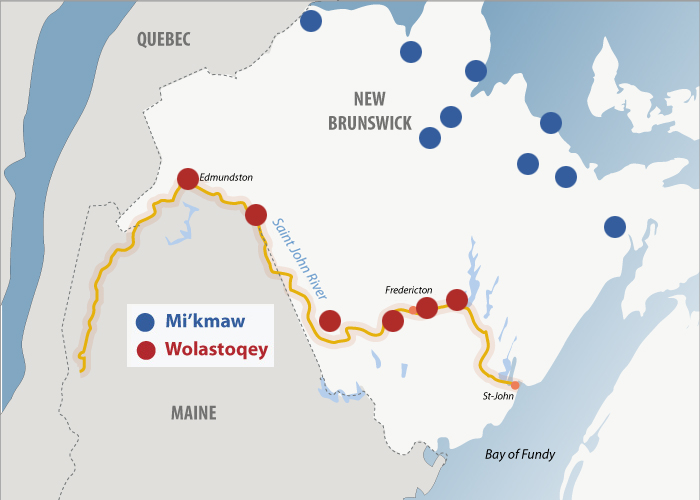
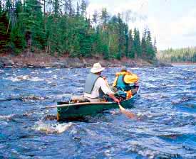
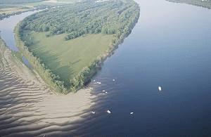
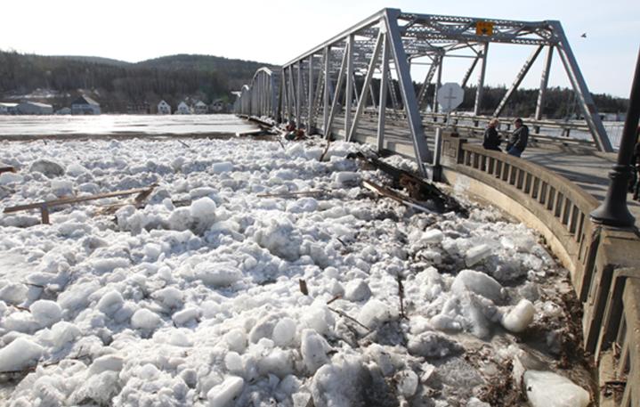
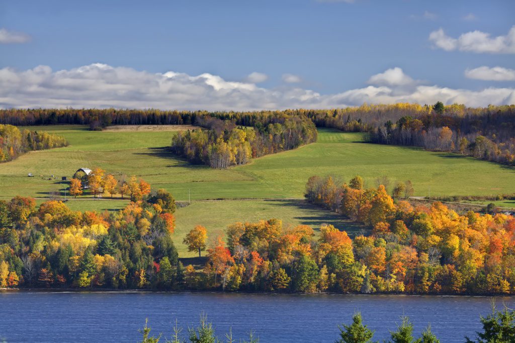
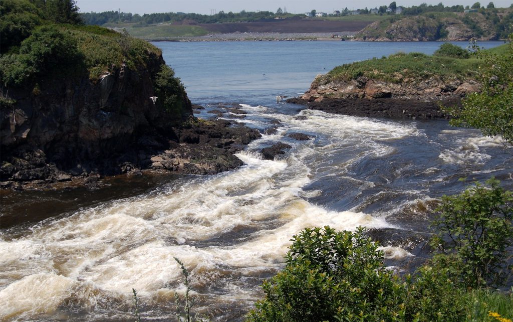
See if you can find the six Wolastoqey communities which are along Wolastoq. From the chart below, read the names of the original communities. Use the photos of Wolastoq. What do these photos tell you about how the ‘Beautiful River’ looks? Using the photographs, place the class into groups to write a short description of each picture. Then try having the class make their own map legend to show these physical descriptions. Have the whole class compare what others have said about their photo. Then, with the class, agree on a map legend to show these physical descriptions. View the map of New Brunswick on a SMART Board. Place the legend on the river of the N.B. map (below).
Or
Go on to a Google Earth map and look at the area where the school or community is located. Each person can make a plasticine map on a 8½” x 11″ sheet of paper of the contours of the river near where the school or community is located, using 3 different colours – brown for earth, green for trees and vegetation, and blue for water. Layer the map showing its elevation. Use the map legend to show the colours.
Which community does this map show? Where was the original village located?
| English | Wolastoqey Latuwewakon | Definition |
|---|---|---|
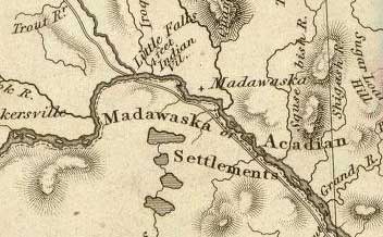
| Madawaska | Matawaskiyak (possible origin of the place name Madawaska) |
At the place where water flows out over grass |
| Tobique | Neqotkuk | A place where one river flows under another river |
| Woodstock (Woodstock First Nation is the second site for this group of Wolastoqewiyik people. The first site was downriver near the community of Meductic) |
Wotstak (the Woodstock First Nation community was originally established at Meductic) |
End of the trail |
| Kingsclear | Pilick | The village |
| St. Mary’s | Sitansisk | The place of the Blessed Virgin Mary |
| Fredericton to Silverwood area | Eqpahak | At head of tide on river |
| Oromocto | Welamukotuk | A good fishing place |
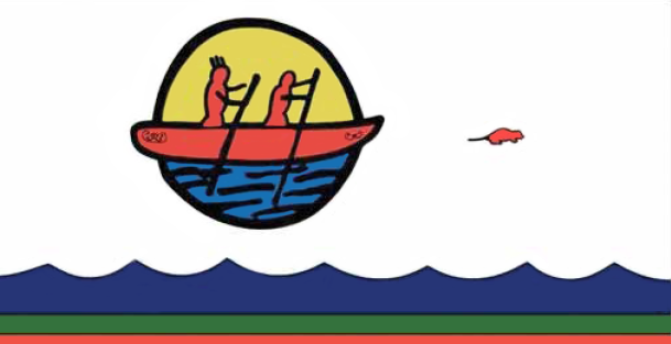
Wolastoqewiyik were also known as people of the muskrat. The muskrat was used for food and fur. Its habitat produced medicine. The ‘double curve’ designs on the canoe are meaningful to Waponahkik. These designs were found in caves. It is a pattern found often in nature like the coil of a fiddlehead, or the path animals take when bedding down so that any animal following must, while following the spiral path, come upwind of them.
Colours
- Red symbolizes Ancestors who have gone before us
- Green symbolizes the earth and all vegetation
- Blue symbolizes all water life – rivers, brooks, streams, lakes and oceans
The red rodent is a Muskrat. Wolastoqewiyik followed the muskrat for guidance to medicine and also used the muskrat for food and fur.
- Red female and male canoeists represent Wolastoqewiyik (Maliseet)
- Yellow symbolizes the Sun which gives us light and helps all vegetation and life to grow
Left to Right:
- http://chrs.ca/the-rivers/st-john/
- https://mainerivers.org/watershed-profiles/st-john-river/
- http://www.travelinnewbrunswick.com/St-John-River-Valley.cfm
- https://johnwood1946.wordpress.com/2013/06/26/st-john-river-andover-to-fredericton
- http://chrs.ca/the-rivers/st-john/
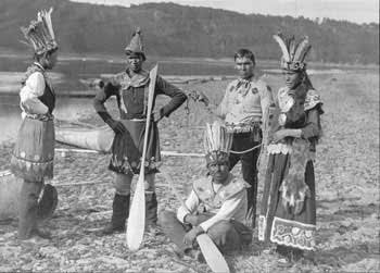
- Wolastoqewiyik at Kingsclear celebrating Corpus Christi Day 1887 NB Public Archives P5-279
- https://www.britannica.com/place/Saint-John-River-North-America

